

Seed Grant Project · Digital Cartography
Mapping Tartary: A Digital Exploration of European Cartography
A 2026 DHI seed project mapping four centuries of European maps of Tartary.
For four centuries European mapmakers drew a region they had never seen. This project turns that archive of guesswork into a searchable, annotated digital atlas.
- 30+maps published online
- 16th–18th c.printed European maps
- GISannotation of selected maps
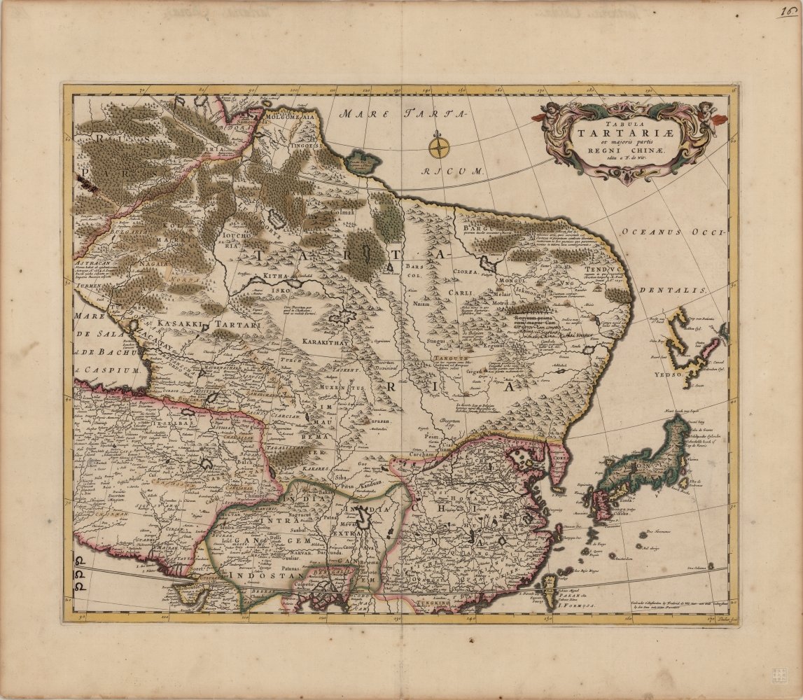
A European printed map of Tartary — the object the platform annotates.
The project
From the rise of the Mongol Empire to the Qing expansion into Xinjiang, “Tartary” was the word Europeans used for the vast, half-known territories of Central Asia. News of the region reached Europe through the commercial and knowledge centres of the Netherlands and Italy, and from the late sixteenth century it was fixed in print — in maps and atlases that shaped how Europe pictured Inner Asia for two hundred years.
HKUST holds a distinctive collection of these European maps of China and Tartary. Scholarship on the maps of China is rich; a comparable study of Tartary has been missing. This project builds the platform that fills that gap.
Tartary was the name Europe gave to the parts of Asia it could only imagine.
Timeline
- 13th c. The Mongol Empire makes Central Asia a single political space.
- late 16th c. Printed atlases in the Low Countries fix “Tartary” on the European page.
- 18th c. Qing expansion into Xinjiang changes what travellers can report.
- 2022 Regnum Chinae: The Printed Western Maps of China to 1735 (Brill) maps the field.
- 2026 A public preview of the Tartary platform.
Objectives
Build the repository
A digital collection of European maps of Tartary printed between the sixteenth and eighteenth centuries, starting from HKUST holdings and extended with open-access and partner collections.
Add new analysis
Features beyond the companion Mappa Sinica site: visualising printing places, the relationships between maps, and the identification of placenames.
Annotate in depth
GIS analysis of selected maps, recording spatial accuracy, cartographic borrowing and the evolution of geographical knowledge.
Milestones (seed grant phase)
- A fuller list of European maps of Tartary, with at least 30 maps published online with metadata and standard descriptions.
- Detailed annotation and GIS analysis of at least one representative map of Tartary.
- A public preview of the website framework, designed to scale into a full research platform.
Team
- Dr. Marco CABOARAPrincipal Investigator · Division of Humanities
- Shutong YINStudent assistant · maps, publication history, placenames
- Tze Nam TSANGStudent assistant · website, image acquisition, GIS
- Dr. Steve MAProject support · Division of Humanities
- Yifan WANGProject support · Library
Resources & related work
- Caboara, Marco. Regnum Chinae: The Printed Western Maps of China to 1735. Leiden: Brill, 2022.
- Mappa Sinica — companion website to Regnum Chinae, developed at the HKUST Library.
- Gorshenina, Svetlana. L’invention de l’Asie Centrale. Genève: Librairie Droz, 2014.
- Partner collections: Library of Congress · David Rumsey Map Collection (Stanford) · Amsterdam University Special Collections · British Library · Bibliothèque nationale de France.